Overview
Geospatial products sit on top of some of the messiest, highest-consequence data in software. A single map view can carry dozens of layers, multiple coordinate systems, live feeds, and historical records, and the people using it are rarely GIS specialists. They are responders, analysts, and field teams who need an answer, not a tutorial.
Across Ball Aerospace, Boundless, and Omni Federal I worked on tools that had to take that complexity and make it legible in the moment. That meant deciding what to show, what to hide, and how to make a person trust what is on the screen when the stakes are high.
Why these problems are hard
It is worth being specific about what makes geospatial design difficult, because the difficulty is exactly where the value is.
Dense, heterogeneous data
Layers, projections, formats, and time all stack on one map. The hard part is not rendering it, it is deciding what a person actually needs to see right now and getting everything else out of the way.
High stakes, low patience
A coordinator during a hurricane or an analyst on deadline cannot stop to interpret an ambiguous state. The interface has to read instantly and leave no room for a wrong guess.
Expert tools, non-expert users
GIS power lives behind specialist terminology. Opening it to the broader team means progressive disclosure, sane defaults, and guardrails that keep advanced options available without blocking first-time users.
Accuracy you can trust
A misread pixel can route a crew to the wrong place. Good geospatial UX is as much about conveying confidence, provenance, and freshness as it is about drawing the map.
Selected work
Two projects from this period show the range: one built in a 24-hour emergency window, the other a workflow that opened an expert pipeline to a wider audience.
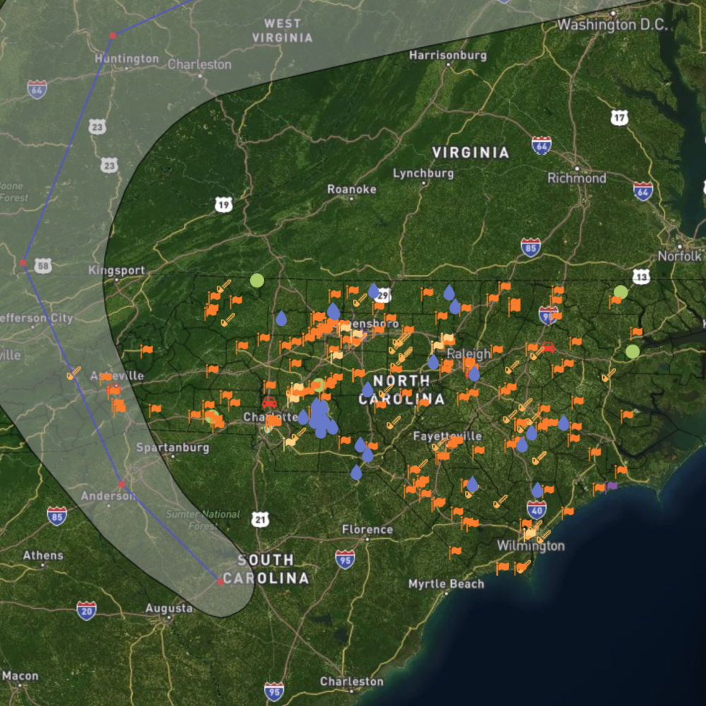
NC Department of Transportation
A real-time incident map shipped in roughly 24 hours so first responders could monitor Hurricane Florence and deploy resources statewide.
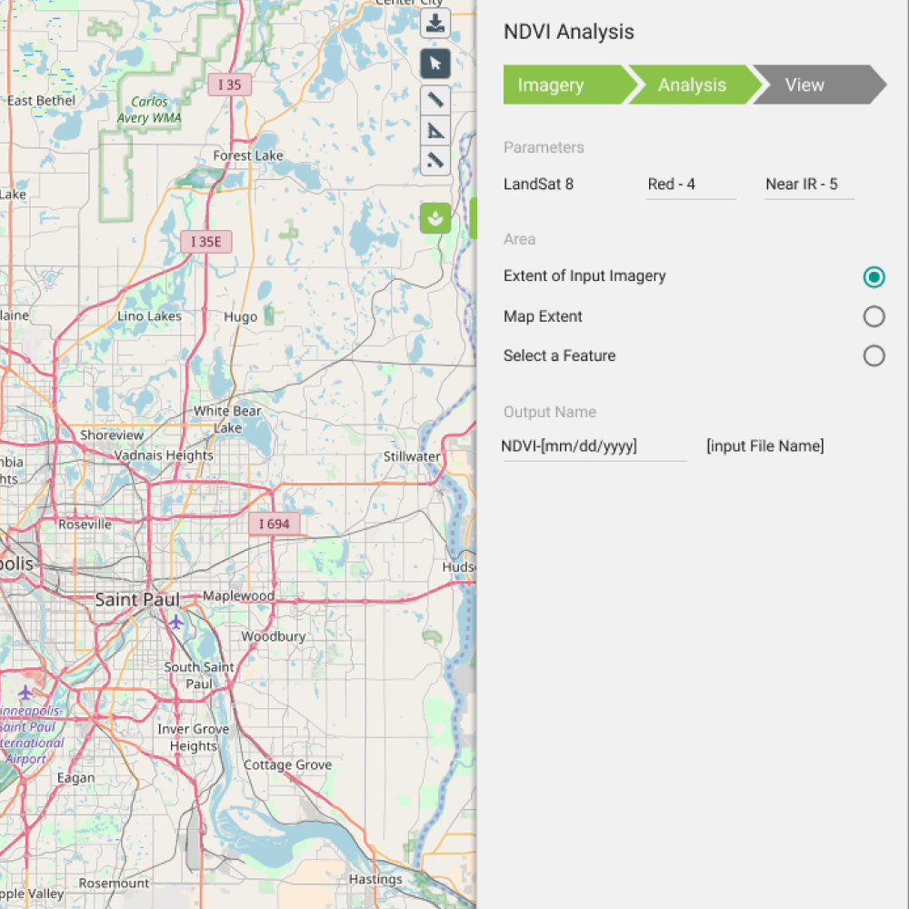
NDVI image processing
A guided vegetation-index workflow that let non-specialists run satellite image analysis and produce server-ready outputs for Boundless Server.
The thread across roles
Geospatial is where I grew from designer to design leader. The same instincts (make the complex legible, partner closely with engineering, respect the stakes) carried through three roles.
Principal Product Designer & Team Lead
2021 – 2022Omni Federal
Led a product design team enhancing geospatial intelligence tools in partnership with infrastructure and software engineering, mentoring designers while simplifying complex technical workflows.
Senior UX Designer & Technical Lead
2016 – 2019Boundless
Technical bridge between product, sales, and platform engineering for web and mobile geospatial tools. Home of the NC DOT emergency map and the NDVI processing workflow.
Senior UX / UI Evangelist
2014 – 2016Ball Aerospace
Led technical product direction for geospatial intelligence mapping and partnered with client engineering on agile web development and sprint reviews.
What it carries into healthcare leadership
A Centene Medicaid portal and an emergency map are the same problem wearing different clothes: dense, regulated data that someone needs to act on, correctly, the first time.
The geospatial years taught me to design for decisions, not dashboards, and to treat trust and accuracy as features, not afterthoughts. That is the same discipline I bring to leading healthcare member experience at Centene, reduce the noise, protect the moment that matters, and build systems my team can extend with confidence.
- Complexity made usableTurning specialist data and tooling into something a broader team can act on, the core of both geospatial and member-portal work.
- Engineering partnershipYears embedded with platform and infrastructure teams shaped how I run design-and-code parity in Fondue today.
- Designing for stakesWhen a wrong screen has real consequences, clarity and trust become non-negotiable design requirements.