Overview
When Hurricane Florence approached the North Carolina coast, showing real-time incident data to first responders became a high priority. Another team member and I spent roughly 24 hours getting this application ready for teams across the state to actively monitor conditions and deploy resources to the most needed areas.
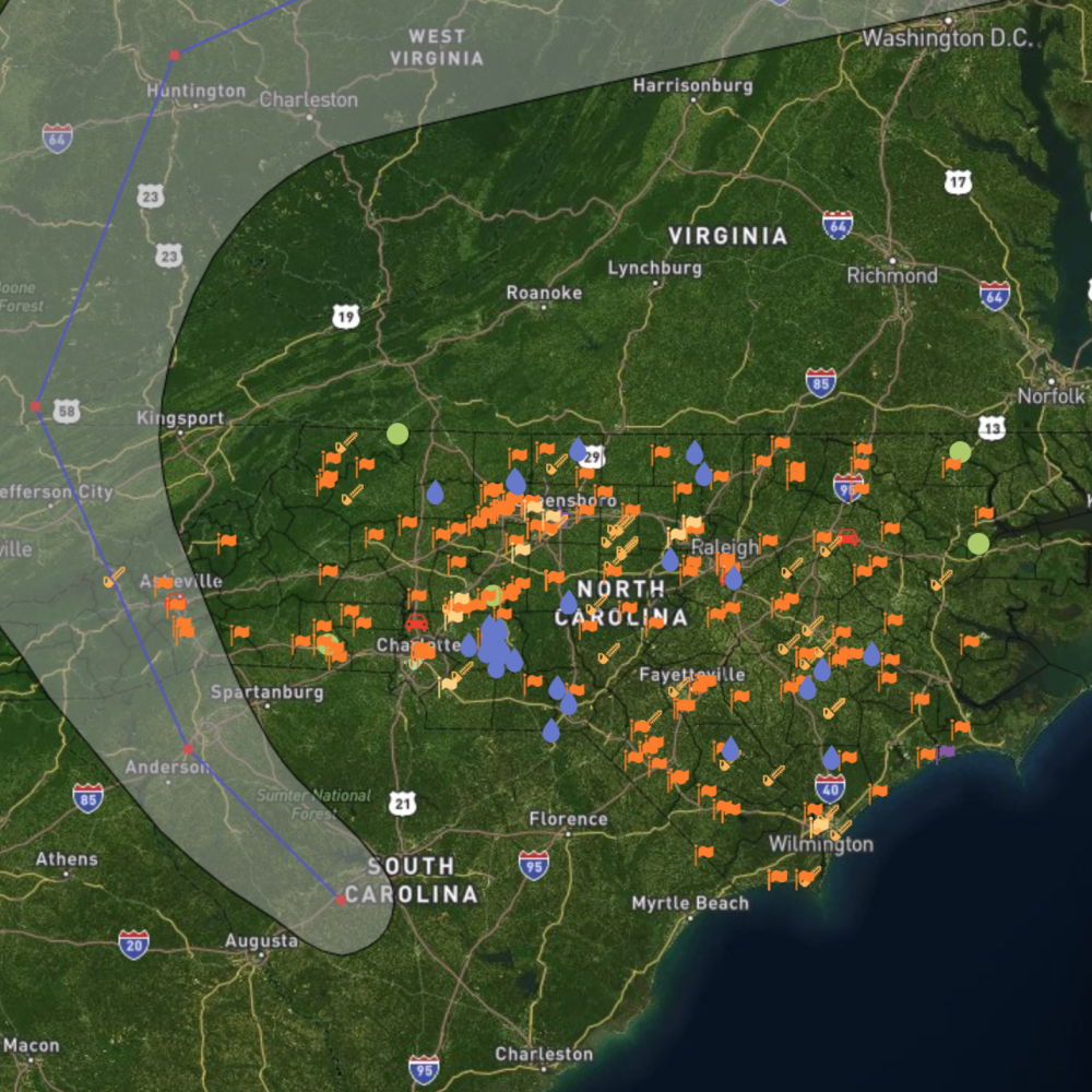
Real-time incident layer over North Carolina
Challenge
Existing tooling wasn't built for the speed and clarity emergency coordinators needed during an active hurricane. Data had to be trustworthy, geospatially accurate, and readable under stress, with no room for ambiguous UI states when routing crews and equipment.
- Extreme time constraint before landfall
- Multiple agencies needing a shared operational picture
- Complex geospatial data that had to read instantly on a map
Approach
We prioritized a single operational map view with incident layers, filtering, and severity cues that coordinators could interpret at a glance. Interaction patterns were kept minimal, with no nested modals or multi-step flows when seconds mattered.
The interface shipped to ncdot.boundlessgeo.io for statewide use during the storm response window.

Priority zones and resource allocation views
Outcome
- Live in 24 hoursShipped a production map tool before Florence made landfall.
- Statewide adoptionTeams across North Carolina used the app to monitor conditions and deploy resources.
- Clarity under pressureReduced cognitive load with a single map-first operational layout.